|
|
Post by kronzky on Apr 17, 2013 15:23:27 GMT -5
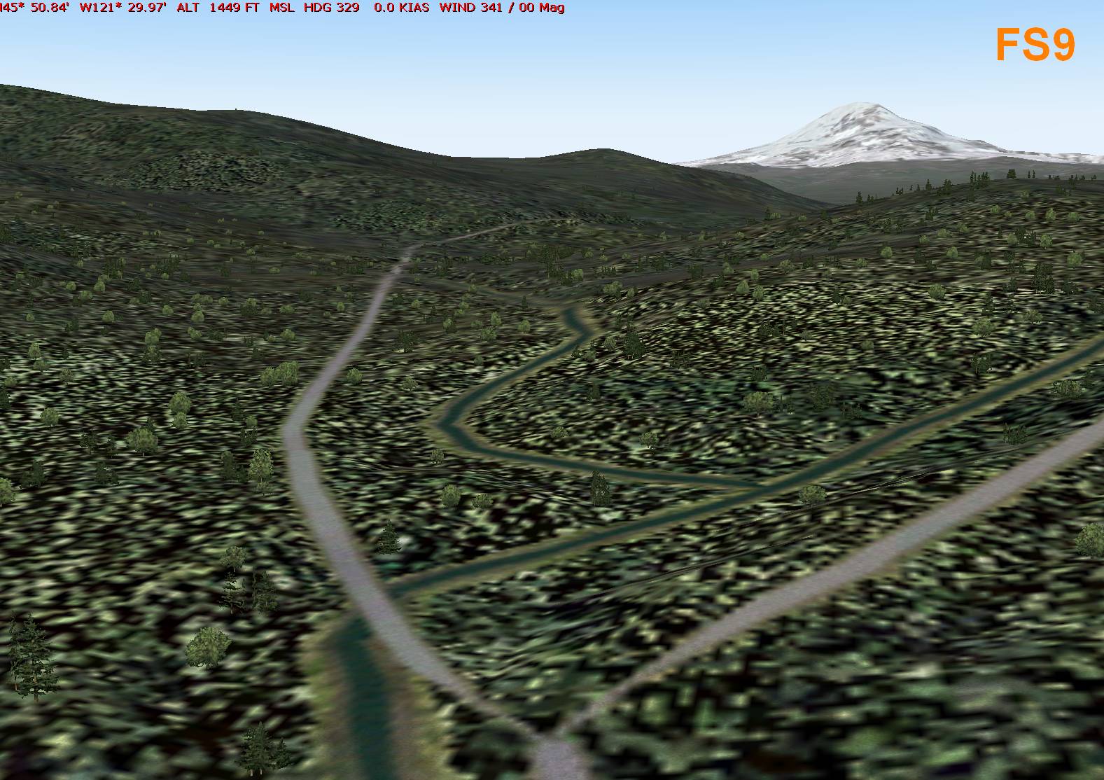
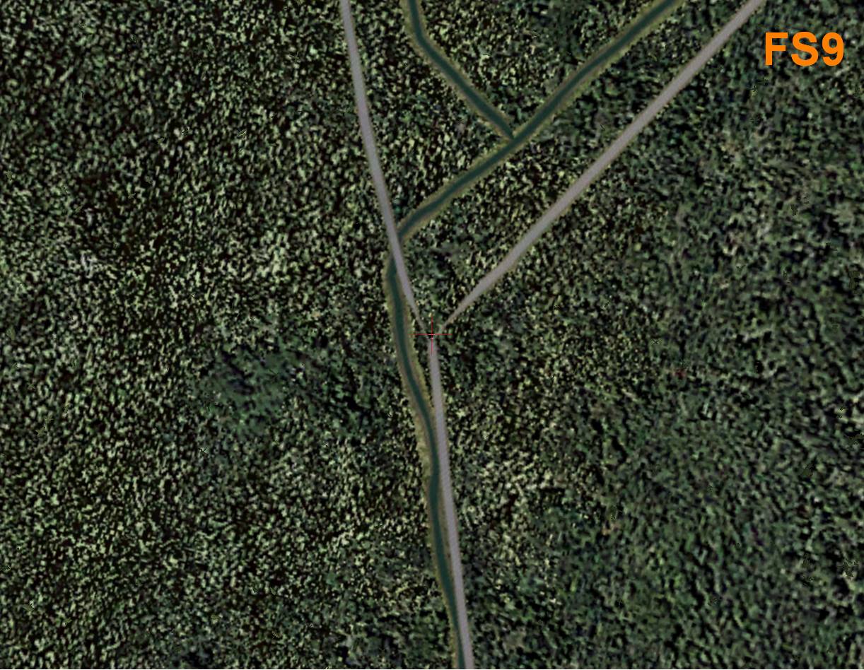
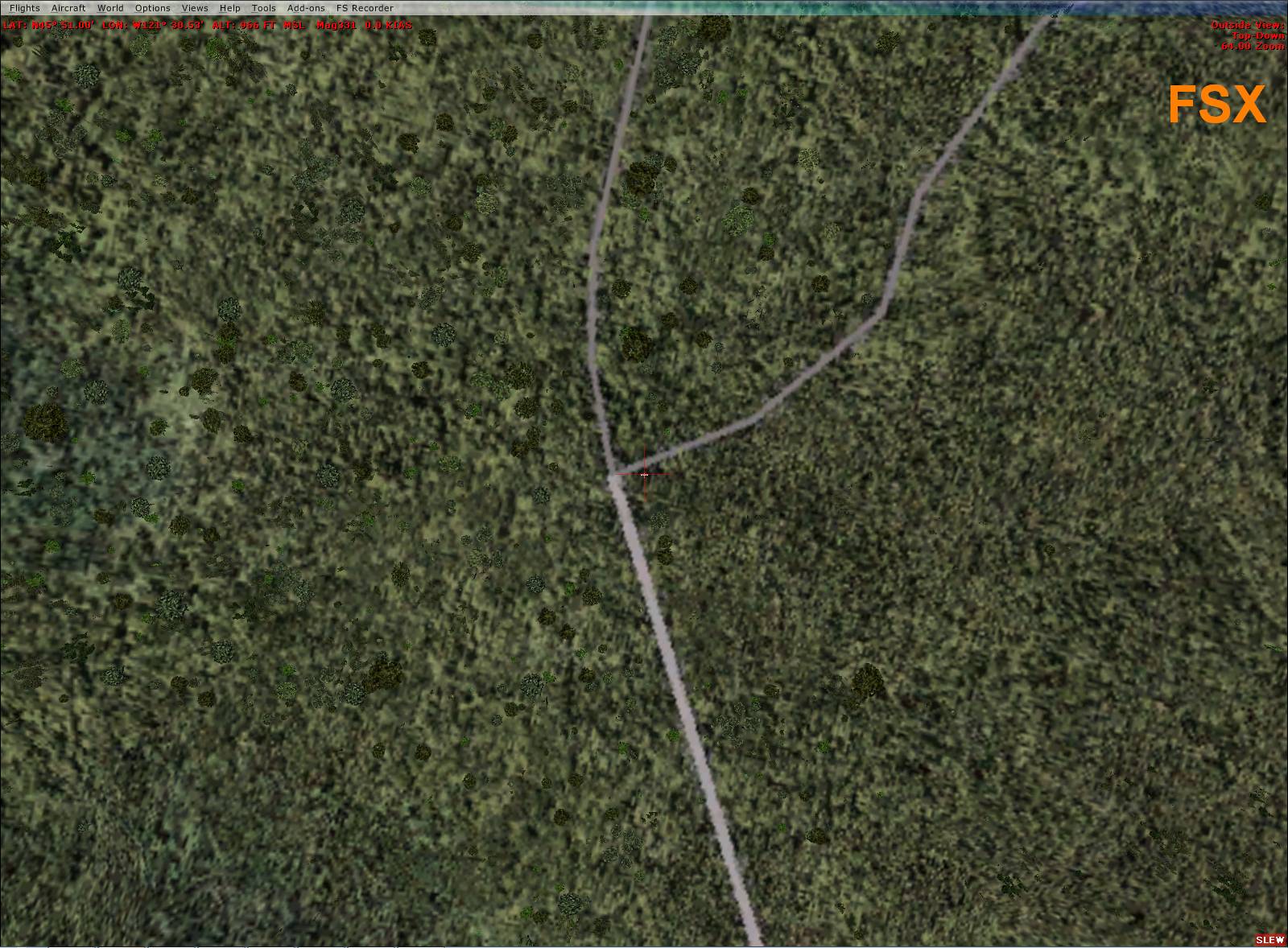
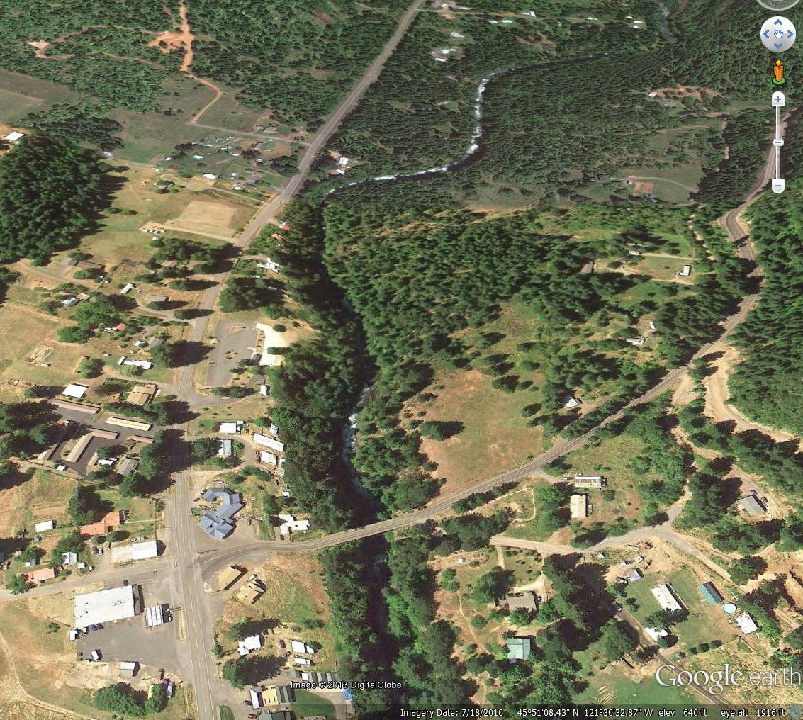
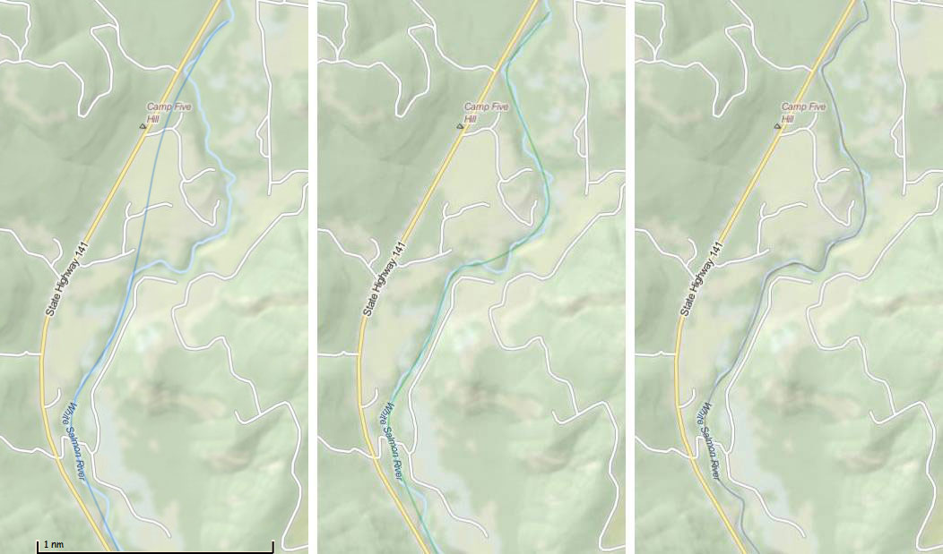
I'm trying to prepare for the race, but I have a very hard time spotting the river during the third leg. In FS9 it is fairly obvious, and easy enough to follow, but when I tried it in FSX I basically had to look at my tracking in Plan-G more than anywhere else, in order to have any idea of where I was supposed to go. I tried different graphics settings (figuring the river might be hidden beneath the trees), but no luck. Has anybody done this so far in FSX? Here are some screenshots from FS9 vs. FSX (as well as how the location looks like in Google Earth): 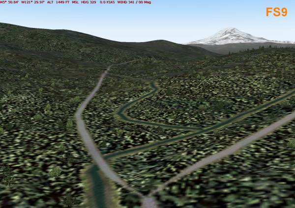 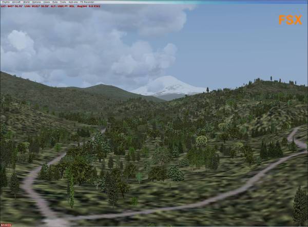 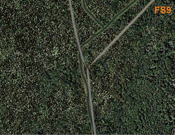 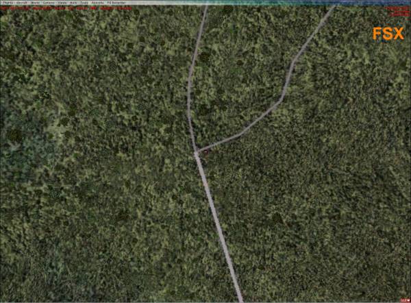  The position is at roughly N45º 50', W121º 30' |
|
codge
Student Pilot

Posts: 33
|
Post by codge on Apr 19, 2013 2:15:08 GMT -5
If you mean the White Salmon river in leg 3 from 4S2 - 66WA, I had the same question. In FSX the White Salmon River is dried up for me but in FS9 there is a trickle. It was this exact situation that I got impatient and fried my GPU over it trying to squeeze every bit of go fast from it that I strangled it.
Take off from 4S2 on rwy 7, turn 90 degrees left and a heading of 335 will line you up for White Salmon river. You'll be flying paralell with your magenta line on your GPS. There should at least be a ditch right in front of you.
I had thought my FSX graphics settings were not high enough to display it and was reluctant to set them higher due to my single core 3Gb dinosaur and then a slide show. It was flying all the legs on both sims before I registered my sim and plane for the month. In the end FS9 won by default!
It wasn't too hard to see where the river was supposed to be after some figure 8 spotting where I thought it should be and just follow it, at times having to guess for a few hundred yards at a time. If you are not too low it is easier to see but there's a bonus for keeping your altitude down.
If you find the higheset altitude point on the whole flight then stay at just under that.
An easy mistake to make especially if you are tired is mixing up 66WA and WA66.
This months hops are very well thought out and such a great place to fly these events. So many small strips everywhere offers so many choices I'll never get bored flying here. Following that river at full throttle is like Red Bull racing for me in the C206!
|
|
codge
Student Pilot
Posts: 33
|
Post by codge on Apr 19, 2013 2:17:40 GMT -5
And to press B on your keyboard to calibrate your altimeter or you risk ripping yourself off in the low alt contest.
|
|
|
|
Post by kronzky on Apr 19, 2013 7:57:55 GMT -5
codge: So were you ever able to actually see the river in FSX, or is that "invisibility" the reason why you finally decided to go with FS9 after all. I do have FS9, but I only really use it for compatibility testing (I develop gauges occasionally). All my planes and utilities are set up for FSX, so it'd be a pain to switch now, just for one race. Perhaps I just have to define a hundred waypoints instead, and fly the course "blind"...  @james: If this is a general (unsolvable) issue with FSX, could us FSX'ers perhaps follow the road instead? Also, how closely are we supposed to "hug" the river (or road)? I've never done an FS race before, so I'm not sure what the tolerances are, and where you're allowed to cut corners. So which of the following ones should we shoot for? 
|
|
codge
Student Pilot
Posts: 33
|
Post by codge on Apr 19, 2013 10:49:47 GMT -5
No, I don't think I could actually see the river in FSX. The road is a good guide to show where it should be.
An honest attempt is all that can realistically be asked of anyone. Following a dried up riverbed at the lowest altitude you can makes for a challenge, to be sure.
I say give it your best shot and come what may.
|
|
|
|
Post by jimmy on Apr 19, 2013 11:33:02 GMT -5
Yeah, just go with the best attempt. Most of the other FSXers have said that the "dried up river bed" was visible as a depression in the ground?
|
|
|
|
Post by kronzky on Apr 19, 2013 13:12:07 GMT -5
Yeah, for most parts you can sort of follow the little depression. But in some areas there's really nothing to go by. On my first test run I was able (with lots of peeking at Plan-G tracking) to closely follow about 80%, but for the rest I may have been off by a couple of hundred feet. So I guess "best attempt" it's gonna be! |
|
|
|
Post by jimmy on Apr 19, 2013 17:11:36 GMT -5
From a judges point of view, it will not really be possible to tell if you're off by a couple of hundred feet. Especially with different simulators, different mesh add-ons, ORBX or not, etc.... your river might look different than the next guy's, and his is different than mine. Every single person could follow the river perfectly (in their sim), and we could all overlay our tracks in Google Earth and the tracks would probably not match up.
But, it will be possible to tell if you're just flying a GPS-direct route, and not meeting the spirit of intent.
|
|